Context Map
Map showing the location of this segment of the West Bank Barrier.
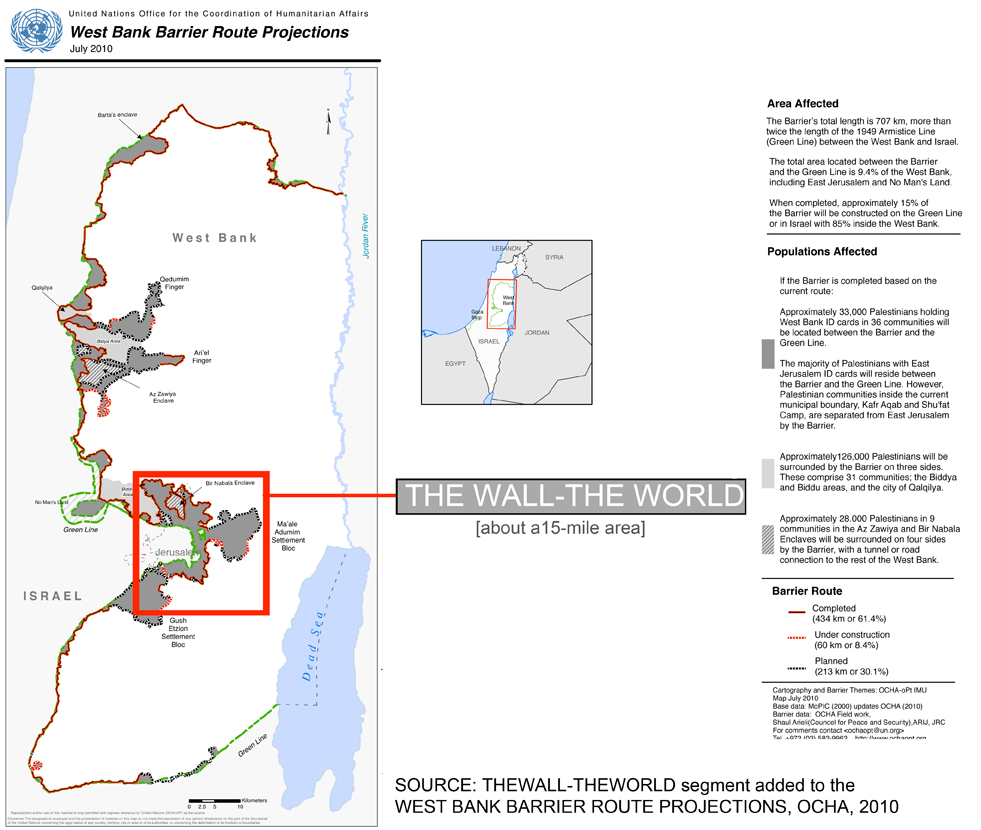
The Wall-The World
Introduction
A barrier is now being built between Israel and the West Bank and it currently runs about 707 km (439 mi) in a country that is about 320 km (200 mi) from top to bottom. It's difficult to imagine the impact this structure has; how it separates village from village, restricts access to and from West Bank and Jerusalem where many residents work, have relatives or go to school.
TheWall-TheWorld focuses on a small segment of the Barrier, about a 15-mile area just east of Jerusalem that extends between Abu Dis in the south and Qalandiya in the north. Viewers can compare the changes the Barrier imposes on any city, perhaps on more familiar ground.
The Barrier severs the flow of people and services that grew out of local histories, economies and proximity. In spite of differences of cultures or politics, the Barrier radically alters daily life both in its place of origin and any sites on which its shadow falls.
TheWall-TheWorld is part of Shadows from another place, a series that maps the impact of distant events in local terms, on local ground.
For more information
Map of the The West Bank Barrier Route Projects, July 2010United Nations Office of Coordination of Humanitarian Affairs (OCHA)
Maps of the Barrier focusing on various locations within the West bank
United Nations Office for the Coordination of Humanitarian Affairs (OCHA)
Related projects
Shadows from another place: TheWallCartographic snapshot of a 15 mile area east of Jerusalem documenting the impact of the West Bank Barrier on daily lives and economies.
http://thewall.name
Shadows from another place: San Francisco-Baghdad
A turn about mapping of the first night of the U.S. invasion of Baghdad on San Francisco documenting each bomb and missile site in SF with GPS, maps and photos.
http://shadowsfromanotherplace.net